Built on chalk
“My journey from Antarctic survey geologist to Cretaceous specialist, engineering geologist, lecturer and consultant was unplanned, yet it always circled back to the Chalk.” For Rory Mortimore, the Chalk remains an enduring source of intrigue

In the UK, the iconic White Cliffs of Dover symbolise an emotional connection to home (© Alamy).
Chalk—a distinctive rock that is so familiar to people living in northern and western Europe—carries cultural significance in the UK where, particularly since World War II, the iconic White Cliffs of Dover are viewed as a symbol of national identity and an emotional connection to home.
Formed over millions of years during the Late Cretaceous, “the Chalk” (as the lithostratigraphic unit is commonly called in the UK) results from the accumulation and compaction of vast masses of microscopic calcite exoskeletons (coccoliths) of marine phytoplankton on the seafloor. Before the mid-20th century, geologists paid the Chalk little attention, dismissing it as uninteresting, monotonous and economically unimportant. However, the discovery of hydrocarbon reservoirs in the Chalk beneath the North Sea, as well as the post-war boom in construction projects and growing demand for the water stored in Chalk aquifers, necessitated a deeper understanding and, in the 1960s and 1970s, a quiet revolution began.
At the heart of this revolution was Rory Mortimore who, together with his contemporaries, helped transform perceptions of the Chalk into a complex, finely stratified and tectonically intriguing unit. But Rory’s journey into geology, and particularly his passion for the Chalk, was not a straightforward one.
Laying the foundation
Rory’s interest in the natural world began during childhood, whiling away the days with the animals on a farm in County Wexford, Ireland. Trips to the Wexford coastal cliffs at Hook Head to see Atlantic rollers charging up seaward-dipping slabs of fossil-filled rocks raised questions about how the rocks had got there. These early experiences blossomed into a fascination with Earth science, an interest nurtured at Kingham Hill boarding school in Oxfordshire. There Rory stumbled across library books detailing expeditions to the Gobi Desert in search of evidence for dinosaurs and early humans during the 1920s and listened eagerly to stories told by one particularly inspiring teacher of time spent working as a mining geologist in Australia. These early experiences nurtured Rory’s dream of one day going on his own exotic expeditions and perhaps becoming a geologist.
After leaving school without the qualifications for university, Rory served in the British Army, first with the Royal Green Jackets and then with the Brigade of Gurkhas in Malaysia and Hong Kong. It was redundancy from this role in the 1960s that finally allowed Rory to pursue his interest in geology. He returned to the UK to complete his A-levels and enrolled on an undergraduate geology course at the University of Hull. Rory knew immediately that he had made the right decision.
“Who could not enjoy getting out onto the Chalk of the Yorkshire Wolds and Flamborough coastline at weekends or first-year mapping in the metamorphic and igneous rocks of north Donegal coast of Ireland or exploring for minerals in the north Pennine Askrigg and Alston blocks?”
During his second year, Rory joined a team from the University of Oxford that hoped to sample Devonian and Jurassic rocks near Jajarm in the Eastern Alborz Mountains of Iran. Political issues forced the team to work instead in the remote Robat-e Qarah Bil area in the northeast of the country, mapping a complex, 2000-m-thick sedimentary sequence spanning the Cambrian to Cretaceous. This shift in field location drove Rory and the team to study the Silurian, as well as the Devonian rocks:
“It was rewarding to find in Iran the similar Silurian brachiopods and trilobites I had seen only a few weeks before in quarries along Wenlock Edge in Shropshire.”
After graduating, Rory joined the British Antarctic Survey hoping to study the Antarctic Peninsula for a PhD—an opportunity that seemed like a dream come true until, in the wake of the 1973 Arab–Israeli war, fuel prices rocketed meaning that numerous research missions, including Rory’s PhD research, had to be abandoned. However, Rory suggests that his subsequent role as an Antarctic Survey Geologist and redirection to study the Jurassic-Early Cretaceous Cumberland Bay Formation (a thick, folded, deformed and metamorphosed turbidite succession on the sub-Antarctic island of South Georgia) was an “unexpected twist of fate that had implications for my subsequent work on the Chalk.”
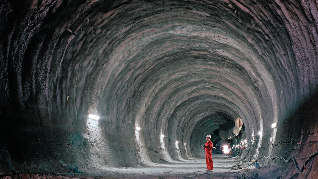
An engineer examines a section of the Channel Tunnel. Built between 1987 and 1994 by an Anglo-French consortium, the Channel Tunnel is the longest undersea tunnel in the world stretching to almost 50.5 km long (© Alamy).
The Chalk
It was in 1974 that Rory was offered another chance of a PhD position at Brighton Polytechnic (now the University of Brighton), a joint geology and engineering project studying the Chalk. Many academics considered the Chalk dull, but Rory accepted the post on the basis that “no part of the geological column could be that uninteresting”. And Rory’s early fieldwork proved him right with “the completely unexpected discovery of slump folds, syn-sedimentary slides and sedimentary carbonate dykes at Seaford Head and Portsdown” reminiscent of the complexities he’d observed in South Georgia’s Cumberland Bay Formation volcaniclastics.
Rory showcased the ideas from his PhD research during the 1977 Geologists’ Association field meeting, A Chalk Revolution, which marked the start of long-standing collaborations with colleagues from across the UK and Europe, and particularly with Chris Wood and Ramues Gallois (both from the British Geological Survey), Bernard Pomerol (University of Paris) and Gundolf Ernst and his research team (Berlin Frei University). Over the following years, they were together able to demonstrate that Chalk outcrops in the UK, particularly those in southern England, could be correlated over hundreds of kilometres with those observed in western and northern Europe.
“In Germany, in the Late Cretaceous Subhercynian basins north of the Harz in Lower Saxony and in the Münsterland Basin, we observed huge slump beds and submarine slides sloughed off tectonically driven, fault-bounded ‘highs’. These occurred at broadly the same time as the smaller-scale slumps and slides we’d observed in the Chalk of southern England at Seaford Head and Portsdown. These observations—still controversial—have since been linked to comparable events in the Chalk of the Paris Basin, France, as well as in the North Sea and Faroe-Shetland basins.”
The structural and sedimentary nature of the Chalk was causing problems in engineering projects, including road construction, building foundations and tunnelling projects, in England and France, as well as in some Norwegian North Sea hydrocarbon fields. It became clear that existing methods for describing and classifying the Chalk were inadequate, and that geologists (including petroleum geologists, hydrogeologists and engineering geologists) and civil engineers would benefit from joining forces across borders to build a common geological framework for the Chalk specifically.
Rory, now in a full-time joint teaching and research post at Brighton Polytechnic, and his colleagues helped bring these groups together for the 1989 Brighton Chalk Symposium (published in 1990 as CHALK by Thomas Telford) which ultimately led to the CIRIA Engineering in Chalk guidance. Before formal publication in 2002, this guidance was put to the test during two major engineering projects—the A27 Brighton Bypass and the Channel Tunnel Rail Link from Dover to Kings Cross—and has subsequently become the industry standard document for designing and constructing in Chalk in the UK, and a key reference document in Northern Europe (where it is used alongside national standards and Eurocodes).
Geoscientists need to teach machines to recognise unexpected geology
A new chapter
After 33 years at the University of Brighton, during which time Rory helped establish a multidisciplinary Master of Engineering (a four-year undergraduate MEng degree with close and essential industry ties), as well as a joint-honours Geology & Geography and single-honours Geology degree course, Rory retired from academia to launch his consultancy firm ChalkRock Ltd. and work on his own research.
“The focus of the last 20 years has been on tunnels under London for Crossrail, the Thames Water Tideway scheme and foundation conditions for wind turbines in the North Sea, Baltic Sea and Western Approaches, as well as work on HS2 through the Chiltern Hills and the A303 bypassing Stonehenge.”
At Stonehenge, Rory is following up on his earlier discovery of phosphatic chalk in boreholes cored for the proposed tunnel there with a second discovery: an Upper Carboniferous Coal Measures erratic.
“This remarkable erratic was nearly lost. It had initially been logged as a flint, so it was lucky that I was check-logging the cores on the day before they were due to be taken away and recognised it as a dark grey-to-black, organic-rich, hard shale.”
Rory saved the sample in the hope that it may not only help explain the source of Stonehenge’s phosphatic chalks but also potentially refine interpretations of Late Cretaceous palaeogeography and the wider tectonic setting of the North Atlantic and continental Europe—research he is now working on with colleagues at the British Geological Survey and University College Dublin.
“With respect to the Late Cretaceous, a key question surrounds the reason for the exceptionally high global sea levels at that time, flooding the continental shelves. If a hotspot-induced increase in crustal production along mid-ocean ridges was initially responsible for these high sea levels at the beginning of the Late Cretaceous, how were these sea levels sustained for so long through the whole Late Cretaceous? Was the uplift of ocean basins maintained by serpentinization of the increased volume of ophiolites? Were there special conditions in the mantle driving Late Cretaceous mid-ocean ridge activity?”
Rory is investigating a potential (and surprising) temporal link between the Stonehenge phosphatic chalk, successions from the Inner Hebrides that also contain phosphorites, and events recorded in seismic sections and boreholes from the North Sea and Faroe-Shetland Basin. If these links prove robust, they may help refine the timing of Late Cretaceous sea-level fluctuations and tectonic events, and ultimately shed new light on what caused the unusually high sea levels of the Late Cretaceous.
Adapting to automation
Looking to the future, Rory is interested to see how geoscientists adapt to rapid advances in robotics and AI, noting the great opportunities they offer.
“It would be of immense benefit to a range of industries if information gained from remote drilling, tunnelling and ground instrumentation could be rapidly collected, collated, analysed and compared with possibly similar conditions elsewhere—exactly what AI is good at.”
Fear not, however, while machines may accelerate data gathering, Rory emphasises just how vital skilled and experienced geologists are for identifying subtleties and interpreting ground conditions in context: “Despite the progress that has been made, unexpected geology is regularly encountered in cored boreholes and major engineering projects. It is very easy to miss critical features in rocks and not appreciate the significance of small characteristics that have a great influence on rock behaviour. Geoscientists need to teach machines to recognise unexpected geology. As machines and robots become ever more sophisticated, there is a need for ever more detailed geology, not less.”
Indeed, through five decades of research, Rory has shown that with curiosity and careful observation, even the most familiar rocks—those dismissed as uniform and uninteresting—can reveal hidden geological complexities.
Prof Rory Mortimore, Emeritus Professor of Engineering Geology, University of Brighton, Director of ChalkRock Ltd., UK, and 2026 recipient of the Society’s Wollaston Medal
Interview by Dr Amy Whitchurch, Executive Editor, Geoscientist magazine